
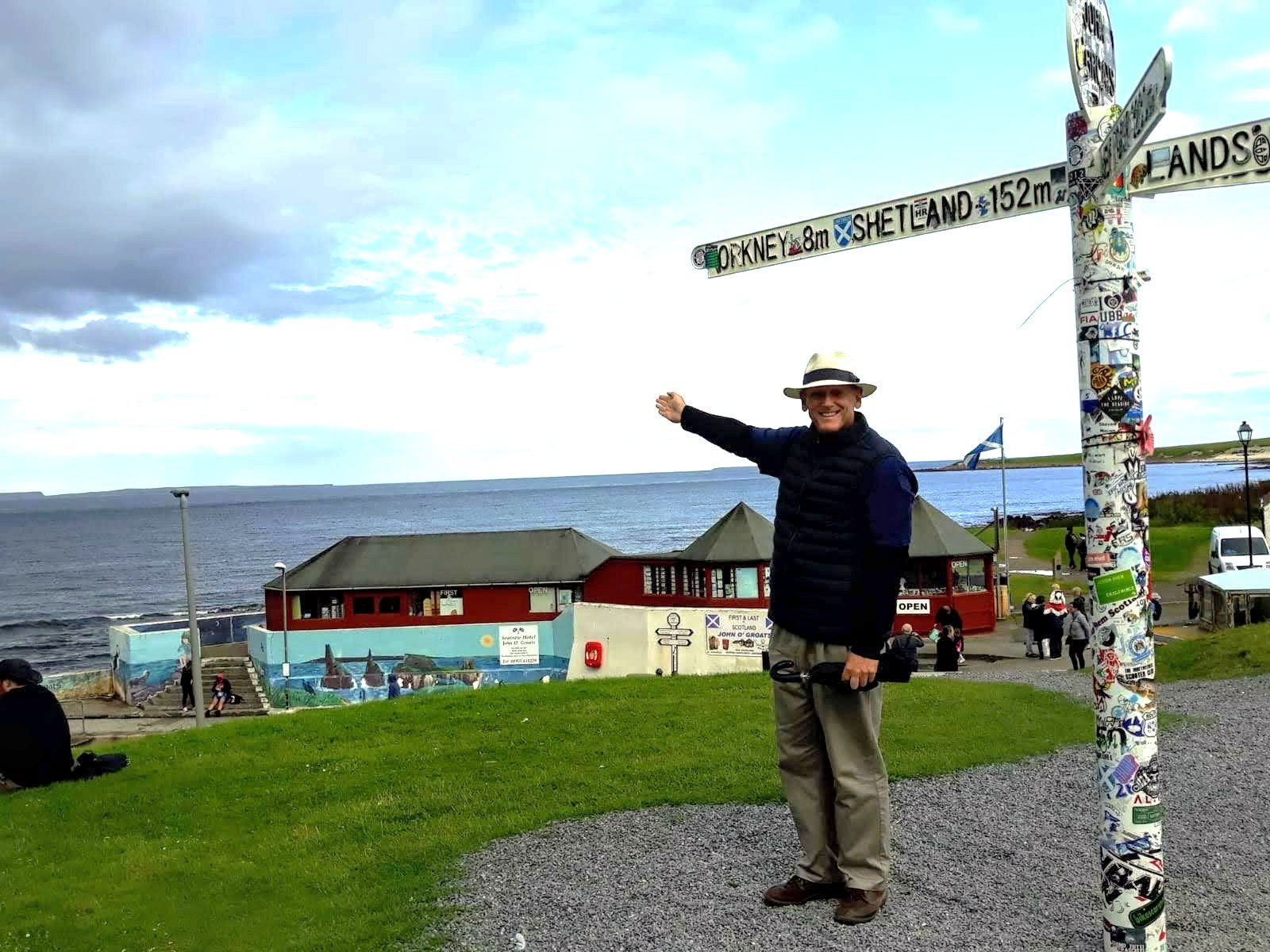
The Orkney Islands are surprisingly close to the north coast of Scotland. The sign at Scotland’s most northern mainland village – John O’Groats – indicates the distance is 8 miles or 12.9 kilometres. It takes less than an hour on a car ferry from the nearby port of Thurso to the islands’ main port, and largest town, of Stromness.
I travelled there with two companions several years ago primarily to visit Scapa Flow, the World War II naval base where one of my great-uncles served as an Australian sailor in 1942. We planned to be there for just a day. Incidentally, the trip there and back was great, we paid a little extra to sit in the equivalent of the members lounge scoffing complimentary snacks and beverages; one companion was keen to get his money’s worth.
This story is part of our Travel Writing & Reflection series. Read more here.
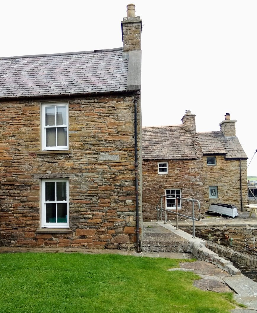
We arrived at Stromness and spent a few hours sight-seeing. It was quaint with stone buildings prominent around the port. It had a real seafaring feel to it – seafood restaurants, port activities and services, fishing vessels, and fish nets strung around – I could smell the salt and seaweed. Even saw a few old barnacles!
The Orkneys are a collection of islands that surround the body of water famously known as Scapa Flow, which became the deep water, home port of the main British fleet – the Home Fleet – in both World Wars. The vessels of the Home Fleet twice dominated the North Sea and the North Atlantic Ocean in the face of German competition.
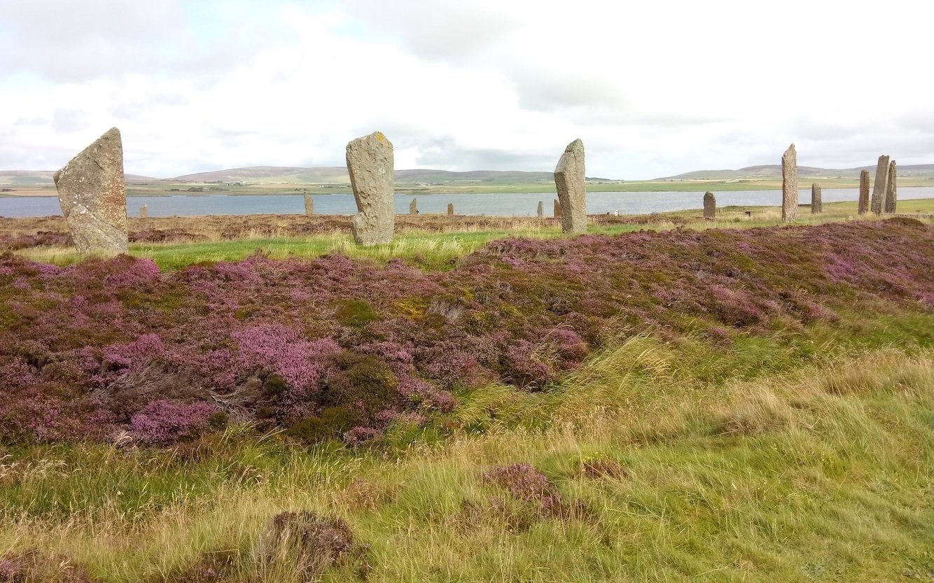
The islands surrounding Scapa Flow are connected by a causeway, dating back to World War II, and you can drive around them in a circular pattern. We took our hire car with us on the car ferry so we could get around rapidly and cram in as much as possible. The islands have great names such as Mainland, Lamb Holm, Glimps Holm, Burray, South Ronaldsay, Flott and Hoy. Mainland and Hoy are the biggest. Please take a look on Google Maps. We set out to explore in our Toyota Prado but to my surprise the main tourist attractions, according to the signage, was not Scapa Flow, or the well-preserved World War II prisoner of war camp for Italians with its prisoner-built Catholic chapel. It was in fact, numerous Neolithic sites, including the evocatively named ‘Ring of Brodgar’.
These were signs, last vestiges, of a civilisation on the island dating back several thousand years! I was intrigued, curious even, and dragged my companions along on this tangent to find out more. Some sites were on Mainland Island, so we headed to the Ring of Brodgar, not completely sure what it was.
Not far, about 9.5 kilometres north-east of Stomness, and well signposted, it was a lovely surprise. My immediate impression was that a bigger, more complete version of Stonehenge had appeared in front of us. Equally mystifying but by far, more picturesque. In fact, it was beautiful. We were on a peninsula inserting itself between the Loch of Harray and the Loch of Stenness. The perfect picture formed … water in the background, heather in the foreground, the Ring in the middle … so Scottish! This was added to significantly by the superb day we had chanced upon despite our northern latitudes. The sun was shining, welcoming us.
We walked all the way around the Ring, hundreds of metres. The tourist signage said originally there were up to 60 stones, of which 27 remained standing. During the walk, the haunting guitar solos performed by Mark Knopfler on the soundtrack to the movie, Local Hero, filled my head. Had it been night-time I imagined witnessing the ‘northern lights’ and the shadows of locals coming out to perform ancient Celtic, Viking or pagan rituals. Our boots were dusty from following in the footsteps of my imagined locals, and many, many generations of their ancestors.
A great mystery was that no one knew why or how the Ring of Brodgar came to be. Further, how did these large 2-3-metre-tall stones get there? Was it a meeting place of the clans? It is the only major henge or stone circle in Britain which was an almost perfect circle. How did it survive untouched?
The tourist signage further advised that the site had resisted attempts at scientific dating, and the age of the Ring remains uncertain. It is generally thought to have been erected between 2500 BCE and 2000 BCE, and was, therefore, among the last of the great Neolithic monuments. That makes the Ring the finest known, truly circular late Neolithic or early Bronze Age henge.
Rightly so, it was a popular tourist attraction. It was well sign posted, replete with descriptive tourist signage and complete with plenty of parking. For good measure, there was a fully-stocked tourist shop reflecting that the Ring was now a UNESCO World Heritage site known as the ‘Heart of Neolithic Orkney’. Yes, there were more sites! But we had no time, after an enjoyable few hours we were off to circumnavigate Scapa Flow and visit the well-preserved World War II Italian prisoner of war camp.

Allan is a former Army officer and logistics specialist. In retirement he writes articles and books ranging across military and naval history, biography and anthropology. He publishes through various association newsletters and websites and on Amazon. He lives in Sydney.