
This is not really about a dusty trail. Its more a muddy and highly stomped trail. Still, if you have never climbed to the highest point in any country, and you have such an achievement on your bucket list, then this may be the easy option for you.
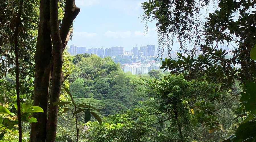
Bukit Timah rises from the surrounding forest, freeways and condo developments to a dizzying altitude of 164 metres above sea level. It is considerably lower than some of the downtown buildings – the cocktail bar in Marina Bay Sands is at 207 metres. You can drive to within a 10 minute walk to the top of Bukit Timah, but that’s not what we are interested in, is it?
The best way to conquer the peak is via a 10-12km walk starting at the MacRitchie Reservoir visitor centre. The nearest MRT station is Marymount, or you can catch one of the many buses along Lornie Road. Have stout shoes suitable for slippery terrain, a bottle of water, a towel or sweat rag and some snacks. You will get very sweaty on the walk, but there are places to refill your water bottle. Plan on it taking half a day as there are some interesting spots to pause along the way.
This story is part of our Australian Back Roads & Remote Travel series. Read more here.
The trail commences along the eastern side of the reservoir, across the dam and past the intrepid paddle-boaters. It then curves to the left, and you follow a generally westerly direction for the remainder of the walk. Everything is well signposted, and you have the choice of following several different tracks. It’s a bit busy on weekends, but weekdays can be quite peaceful and an opportunity to really enjoy the green space and waterways which are one of the amazing things about Singapore. The place is a masterpiece of urban planning, and the forests in the centre of the island are a real pleasure.
There is more wildlife than you might imagine. I’ve done this walk a few times and seen otters, macaques, langur monkeys, snakes, monitor lizards and once I even spotted a pangolin. Bird life is prolific and colourful.
After an hour or so you can get a peek through the fence of the salubrious Singapore Island Country Club. Then it is worth a detour to the treetop walk and a look at Upper Peirce Reservoir. Continuing on, follow the Sime Track through the catchment areas onto Rifle Range Road past some highly fenced industrial and defence sites, and the satellite station. Feet might be getting sore by now but if you sit down beside the road, beware of macaques sneaking up to grab hats and water bottles.
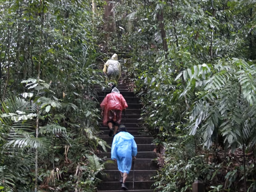
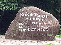
Continue along Rifle Range Road over the expressway and you are ready for the ascent. The closer you get, the busier it is with rowdy kids and teenagers. Climb a couple hundred well-built steps and you get to the summit, where you can enjoy the nicely manicured lawns and take the obligatory photo at the rock. Congratulations, you have made it!
My favourite way to finish the walk is to descend through the carpark, down Hindhede Drive and go to one of the several Malay-style restaurants along Cheong Chin Nam Road. Have a curry and a cold Tiger and get back onto the MRT at Beauty World.
Happy summiting everyone!
If you enjoyed this story you might also like Climb Mount Kosciuszko in Summer, but be Prepared.

Steve is a former Army officer and technology manager, now semi-retired and living in Melbourne. He enjoys adventurous travel and believes that good stories should be shared. He founded the Dusty Boots Journal as a means to connect those with similar interests.